Skip to content

Tremezzina

Villa del Balbianello

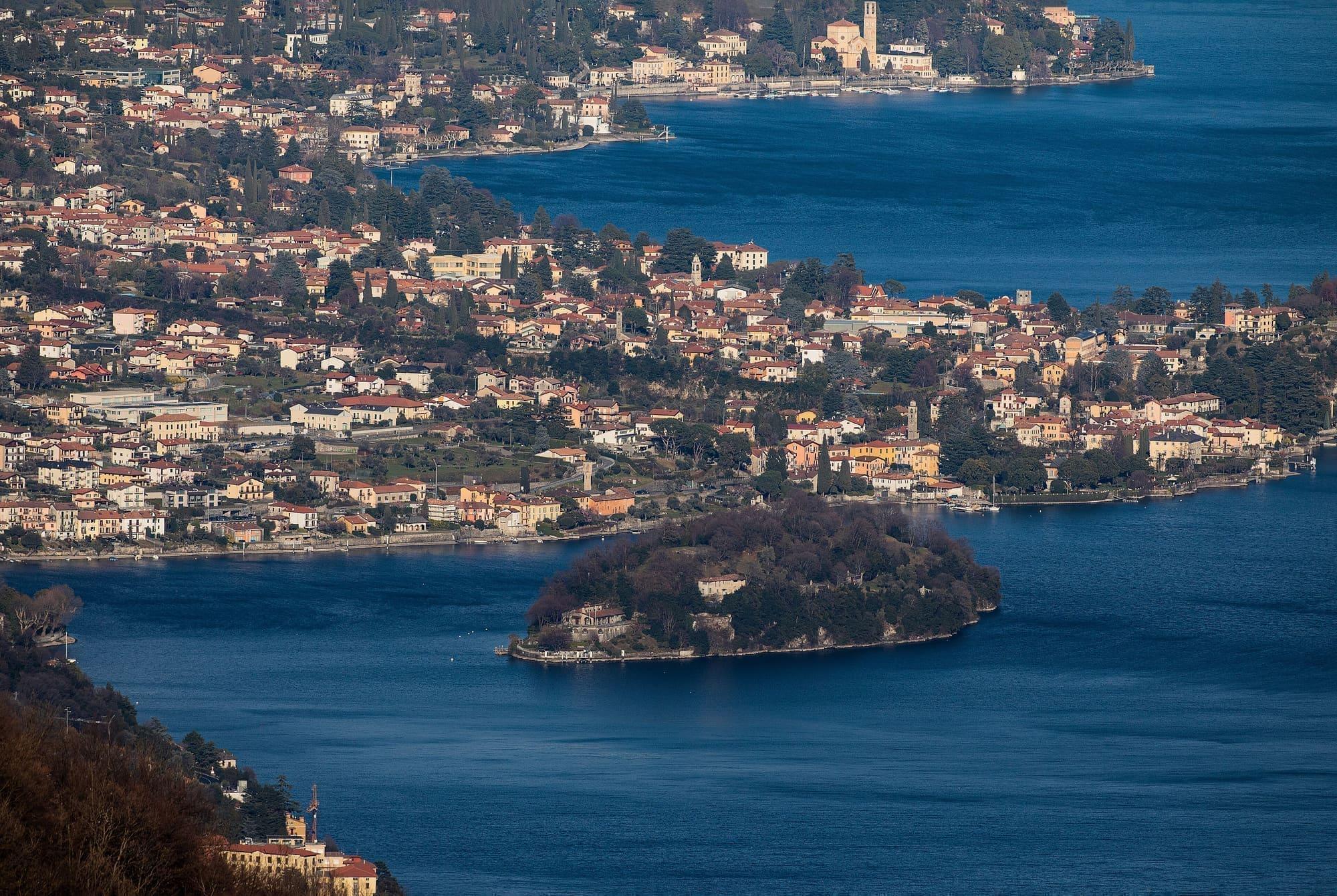
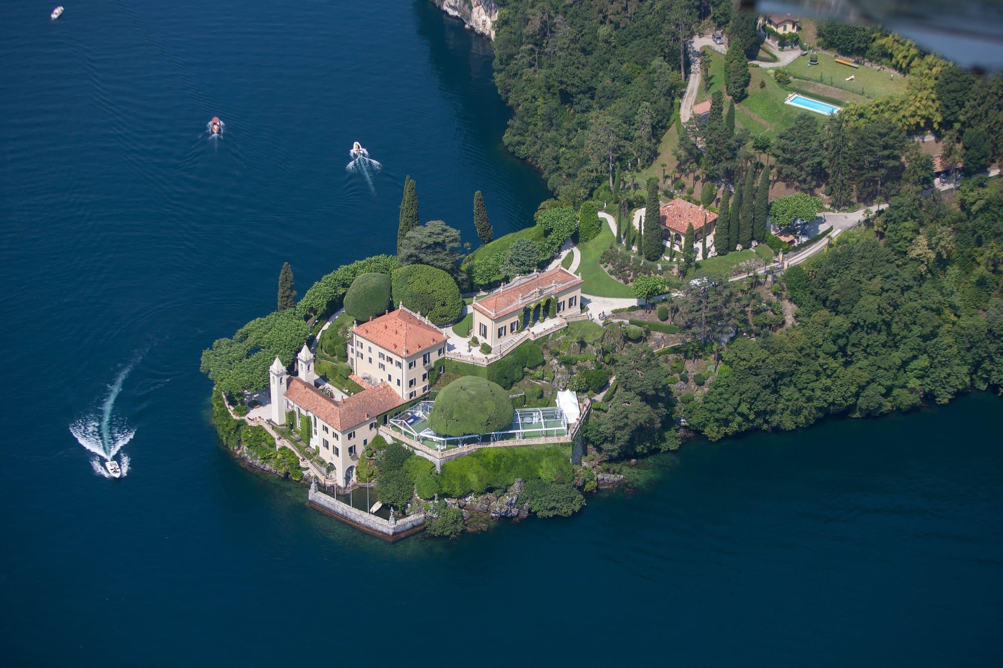
An eighteenth-century FAI villa on the tip of the Lavedo headland at Lenno, with the Durini loggia above the lake and a terraced garden.

Visit duration
1 h 30 – 2 h 30
Booking
Required
Area
Centro Lago
Status
A FAI property
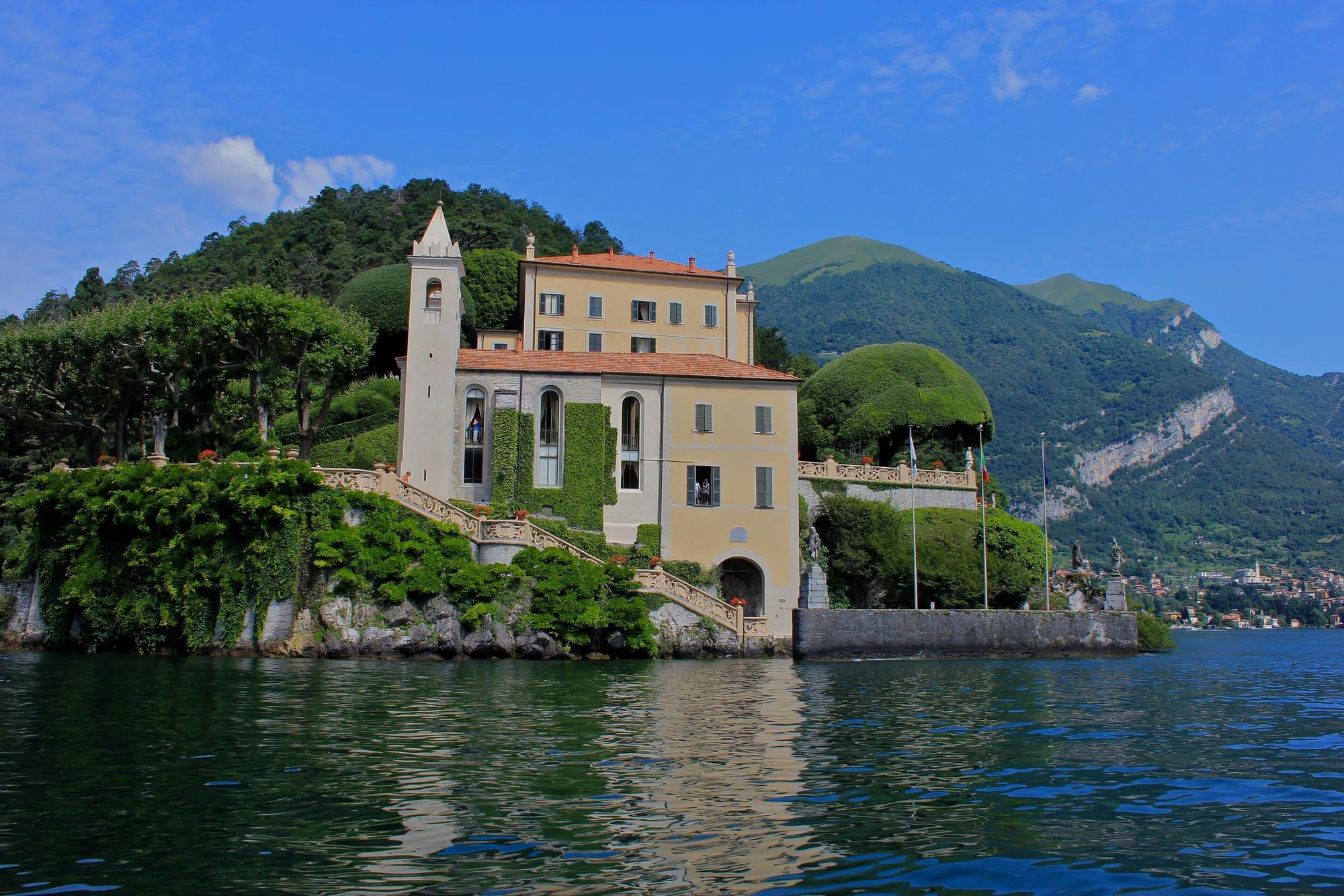
The villa from the water: the yellow fronts, the white bell tower of the old church and the balustraded stair climbing from the lake among the creepers.Navin75 · CC BY-SA 2.0
  • Scott Thompson · CC BY 2.0
  • Jeroen Komen · CC BY-SA 2.0

1 / 3

The villa from the water: the yellow fronts, the white bell tower of the old church and the balustraded stair climbing from the lake among the creepers.

Navin75 · CC BY-SA 2.0

Why go

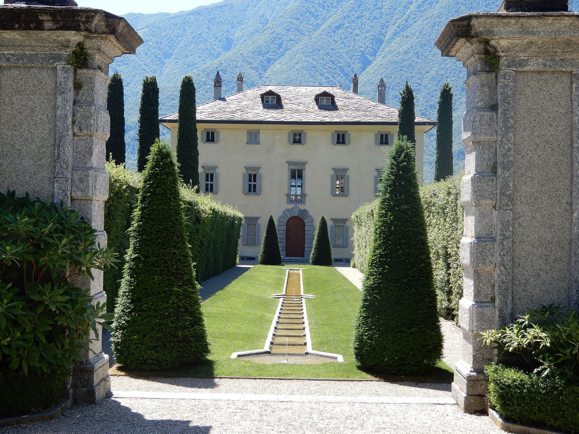
Cardinal Angelo Maria Durini had the villa built in 1787 on the site of a Franciscan friary.

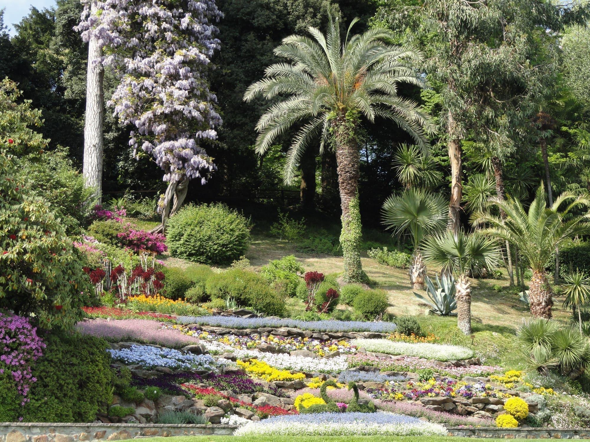
It was the last home of the explorer Guido Monzino, who in 1988 left it to the FAI, the Italian National Trust, with his collection of non-European art and the relics of his Everest and North Pole expeditions, which now make up the museum included in the visit. On the headland, the Durini loggia is open on three sides above the water. The garden steps down in terraces that follow the rock, with staircases and plane trees pruned into candelabra.
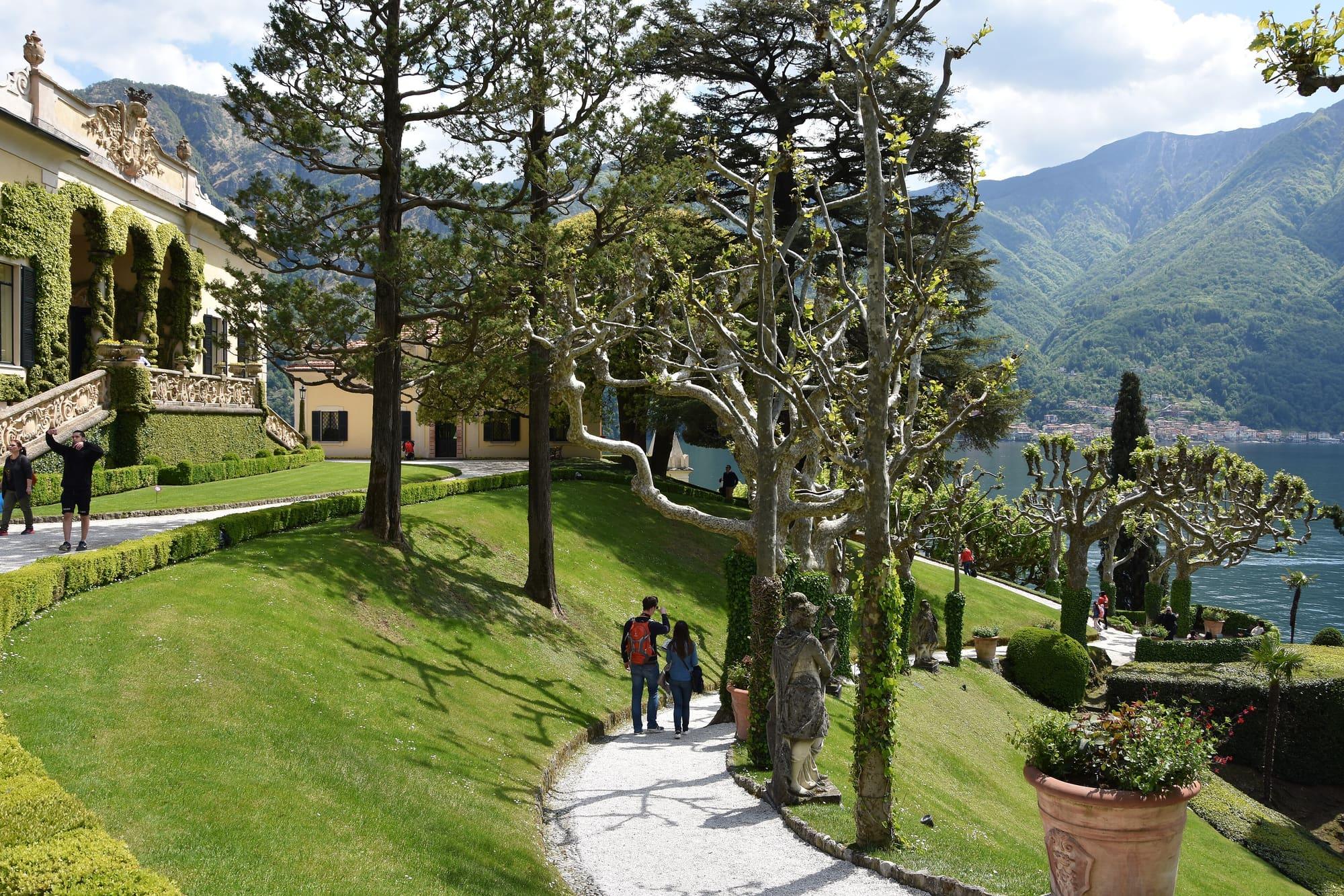
  • A creeping fig covers the arches of the Durini loggia, and a compass rose is inlaid in its floor.
  • The villa's rooms hold eighteenth-century French furniture, Beauvais tapestries and paintings on glass.
  • Under the roof, the expedition museum shows the sledge of the 1971 North Pole expedition and a collection of Inuit ivories.

Getting there

  • On foot from the Lido di Lenno along the peninsula path: a kilometre uphill, partly on gravel, about 25 minutes.
  • By taxi boat from the Lido di Lenno, 5 minutes.
The lawn running down to the lake below the loggia, with its pollarded plane trees, the gravel path and a few visitors.Phyrexian · CC BY-SA 4.0

Accessibility

  • The villa and park are partly accessible to people with reduced mobility or using a wheelchair; the villa's staff should be told before the visit.
  • The footpath from Lenno, a kilometre uphill and partly on gravel, is not suitable for people who have difficulty walking: with notice you can drive up to the ticket office at the park's road entrance, or come by taxi boat from the Lido di Lenno.
  • All the paths in the park slope and are partly gravel. There is one step into the villa; inside, a lift that takes a wheelchair serves three of the six floors. The Durini Loggia is reached by a flight of stairs; the Segrè Loggia has no steps.
  • There are accessible toilets in the Segrè Loggia and beside the landing stage, seats in the park and folding chairs in the villa's main rooms.

Practical information

Address

Via Guido Monzino 1, 22016 Tremezzina

Dogs

Allowed in the garden, always on a lead; inside the buildings only guide dogs and certified assistance dogs

Facilities

Public toilets 39 m away · accessible

Distances from the point on the map.

The light

The lakeside façade faces east: the good light is the morning, until eleven. In the afternoon it is backlit, which is another photograph, with silver water.

Faces
east
Best light
morning
Full moon
Tue 24 Nov · 16:51 · north-east
JuneDecember
10°20°10:1615:52ESW
The skyline measured every two degrees out to twenty-two kilometres, and to two hundred where the near mountains let the Alps show. The solid line is the sun's arc at the summer solstice, which leaves the top of the frame; the dashed one is the winter solstice, with the hour it comes out from behind the mountain and the hour it goes back.

See from here where the sun comes from, in 3D

All the photo spots

Updated 21 October 2026

The mountains from here

The highest summit in view from here is Monte Gruf, 2938 m, 43 kilometres away.

Open the panorama with the summits by name
Monte San Bernardo settentrionale, 1351 m, 10.6 kmMonte San Bernardo settentrionale1351Monte Comana, 1210 m, 8.4 kmMonte Comana1210Monte Gringo, 1079 m, 7.7 kmMonte Gringo1079Monte San Zeno, 1025 m, 9.6 kmMonte San Zeno1025Pizzo della Croce, 1491 m, 11.8 kmPizzo della Croce1491Monte Pasquella, 1331 m, 6.8 kmMonte Pasquella1331Cima della Duaria, 1446 m, 4.8 kmCima della Duaria1446Dosso di Lavedo, 329 m, 0.3 kmDosso di Lavedo329Monte Crocione, 1641 m, 4.6 kmMonte Crocione1641Il Dossone, 903 m, 4.6 kmIl Dossone903Sasso San Martino, 862 m, 4.9 kmSasso San Martino862Monte Gruf, 2938 m, 42.8 kmMonte Gruf2938 · 43 kmMonte Legnoncino, 1711 m, 18.4 kmMonte Legnoncino1711Monte Legnone, 2609 m, 21.9 kmMonte Legnone2609Pizzo Alto, 2512 m, 23.3 kmPizzo Alto2512 · 23 kmSasso Mattolino, 1508 m, 11.8 kmSasso Mattolino1508Monte Fopp, 1090 m, 8.8 kmMonte Fopp1090Pizzo dei Tre Signori, 2554 m, 25.7 kmPizzo dei Tre Signori2554 · 26 kmMonte Pilastro, 1827 m, 11.9 kmMonte Pilastro1827Monte Nuvolone, 1092 m, 2.8 kmMonte Nuvolone1092Ceppo del Mucchio, 1081 m, 3.3 kmCeppo del Mucchio1081Monte Fopa, 1116 m, 3.9 kmMonte Fopa1116Cima del Costone, 1611 m, 6 kmCima del Costone1611Monte San Primo, 1682 m, 5.6 kmMonte San Primo1682Costa San Primo - Cima di Mezzo, 1541 m, 4.6 kmCosta San Primo - Cima di Mezzo1541Costa San Primo - Cima Nord, 1492 m, 4.5 kmCosta San Primo - Cima Nord1492Piz del Luser, 1405 m, 4.5 kmPiz del Luser1405Monte Colmenacco, 1281 m, 4.8 kmMonte Colmenacco1281SWWNWNNEESES
  • Il Dossone, 903 m, 5 km
  • Sasso San Martino, 862 m, 5 km
  • Monte Gruf, 2938 m, 43 km
  • Monte Legnoncino, 1711 m, 18 km
  • Monte Legnone, 2609 m, 22 km
  • Pizzo Alto, 2512 m, 23 km
  • Sasso Mattolino, 1508 m, 12 km
  • Monte Fopp, 1090 m, 9 km
  • Pizzo dei Tre Signori, 2554 m, 26 km
  • Monte Pilastro, 1827 m, 12 km
  • Monte Nuvolone, 1092 m, 3 km
  • Ceppo del Mucchio, 1081 m, 3 km
  • Monte Fopa, 1116 m, 4 km
  • Cima del Costone, 1611 m, 6 km
  • Monte San Primo, 1682 m, 6 km
  • Costa San Primo - Cima di Mezzo, 1541 m, 5 km
  • Costa San Primo - Cima Nord, 1492 m, 5 km
  • Piz del Luser, 1405 m, 5 km
  • Monte Colmenacco, 1281 m, 5 km
  • Monte San Bernardo settentrionale, 1351 m, 11 km
  • Monte Comana, 1210 m, 8 km
  • Monte Gringo, 1079 m, 8 km
  • Monte San Zeno, 1025 m, 10 km
  • Pizzo della Croce, 1491 m, 12 km
  • Monte Pasquella, 1331 m, 7 km
  • Cima della Duaria, 1446 m, 5 km
  • Dosso di Lavedo, 329 m, 0 km
  • Monte Crocione, 1641 m, 5 km

The ochre line follows today's sun path and marks the estimated times of its first and last appearance above the mountains. Drag the panorama to see all of it.

How it is drawn
Paler ridges are farther away; heights are stretched two and a half times. Houses are not drawn, nor are trees within half a kilometre. Terrain © Regione Lombardia (CC BY 4.0); summits © OpenStreetMap contributors.

On the map

Explore the lake
TremezzinaVilla del Balbianello from the water

© OpenStreetMap contributors · ODbL

What's on nearby

Events within a few kilometres, on now or coming up.

See all

Nearby: places, experiences, services

Distances as the crow flies.

Sources and credits

Verified at source1 Oct – 8 Oct 2026

FAI — Fondo per l'Ambiente Italiano:Opening, Ticketsopens in a new tabTelephone, Dogsopens in a new tab
Sources and credits

Verified at source1 Oct – 8 Oct 2026

FAI — Fondo per l'Ambiente Italiano:Opening, Ticketsopens in a new tabTelephone, Dogsopens in a new tab