Skip to content

Val d'Intelvi

Sasso Gordona from the Pian delle Alpi

The summit on the Swiss border regarded as the valley's emblem: an hour from the Pian delle Alpi to the Rifugio Prabello, an hour's steep climb to the summit cross, and on its slopes the tunnels and trenches of the Cadorna Line.

Duration
3 h 30 – 4 h 30
Effort
Demanding
Access
Open to all
Car-free
Needs a car
With children
Not ideal
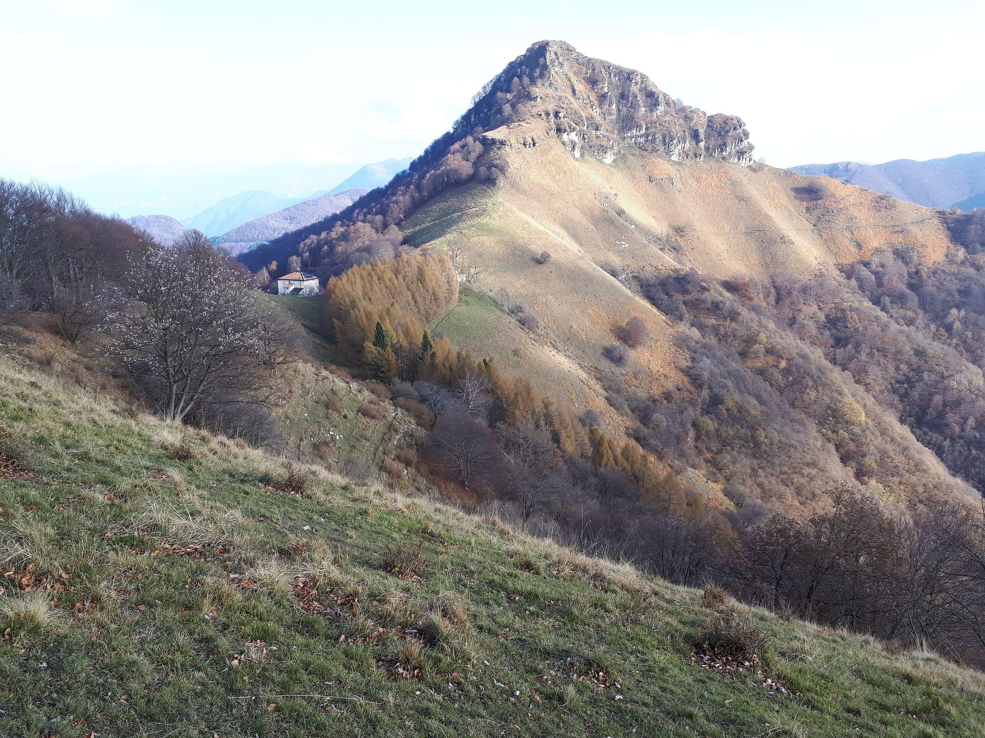
The Sasso Gordona in autumn: the rocky summit above slopes of dry grass and yellow larches, with the Rifugio Prabello small on the ridge to the left.Kaitu · CC BY-SA 4.0
  • Kaitu · CC BY-SA 4.0
  • Kaitu · CC BY-SA 4.0
  • Kaitu · CC BY-SA 4.0

1 / 4

The Sasso Gordona in autumn: the rocky summit above slopes of dry grass and yellow larches, with the Rifugio Prabello small on the ridge to the left.

Kaitu · CC BY-SA 4.0

How it works

The Sasso Gordona is regarded as the emblem mountain of the Valle Intelvi.

It stands on the chain joining Monte Bisbino to Monte Generoso, on the Swiss border, but its summit, at 1410 metres, is on Italian soil, in the comune of Schignano: a tapering peak of Moltrasio limestone topped by a steel cross about four metres high, from the 1930s. You leave the car at the Alpe di Cerano, which the valley calls the Pian delle Alpi, where there is a picnic area; an hour on foot brings you to the Prabello, at about 1200 metres, where the hut of the CAI's Monte Olimpino subsection occupies a former customs guard barracks. From there the climb to the summit, about an hour, is steep and slippery; the two paths to the top are fitted with chains, railings and handholds. Going down the other side you reach the Colma delle Crocette, linked by a mule track to Posa, above Schignano, and to the Via dei Monti Lariani. On the slopes remain the works of the Frontiera Nord, the defence line known as the Cadorna Line, built from 1915 along the Swiss border for fear of an attack from Germany: a tunnel shelter, three smaller walled shelters, three lines of protected trenches and five positions for machine guns or light guns, never used in war. The CAI's Sentiero Italia circles the mountain on a former military road.

  1. From the Pian delle Alpi to the Prabello is an hour's walk; from the hut to the summit takes about another hour, on a steep and slippery ascent. The summit path is graded EE, for experienced hikers; if you would rather not go to the top, you can skirt it on the mule track between Trevìi and the Prabello.
  2. The Pian delle Alpi is reached by car from Piazza Carminati at San Fedele, in Centro Valle Intelvi: take the provincial road towards Alta Valle Intelvi and Lanzo, turn left after the shopping centre into Via Casasco as far as Casasco, and from there follow the signs for Piano delle Alpi or Erbonne for three and a half kilometres.
  3. The Rifugio Prabello belongs to the Monte Olimpino subsection of the CAI's Como section; ask whether it is open before setting off.
  4. The Via dei Monti Lariani passes below the north face, and the Prabello is the end point of a stage of the CAI's Sentiero Italia, the one that climbs from Monte Olimpino by the Bisbino.

WhereLanzo d'Intelvi

On the map

Explore the lake
Lanzo d'IntelviSasso Gordona from the Pian delle Alpi

© OpenStreetMap contributors · ODbL

What's on nearby

Events within a few kilometres, on now or coming up.

See all

Nearby: places, experiences, services

Sources and credits

Sources and credits