Skip to content

Nesso

Orrido di Nesso

A waterfall entering the lake under a stone bridge, at the bottom of three hundred steps.

Visit duration
45 min – 1 h 30
Booking
Not required
Area
The Triangle
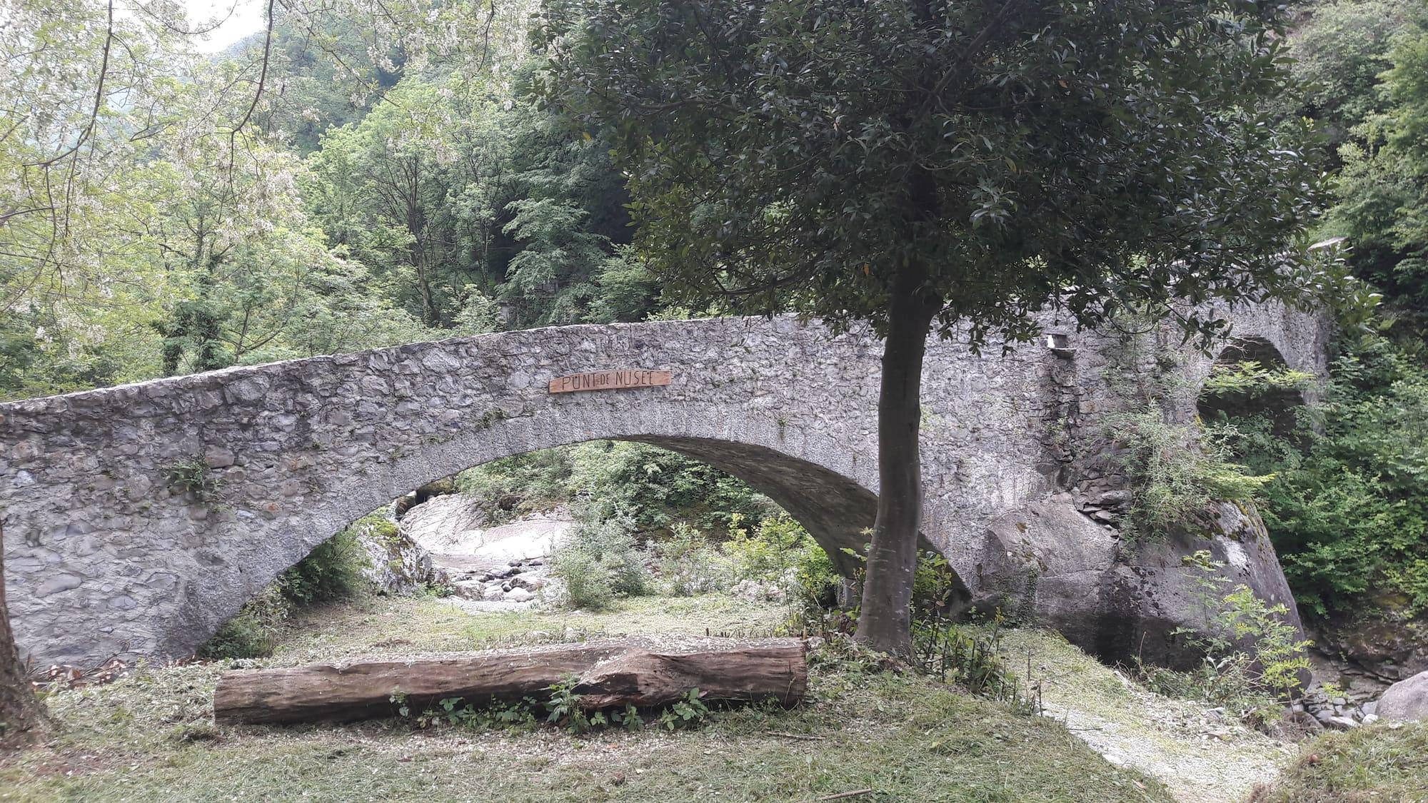
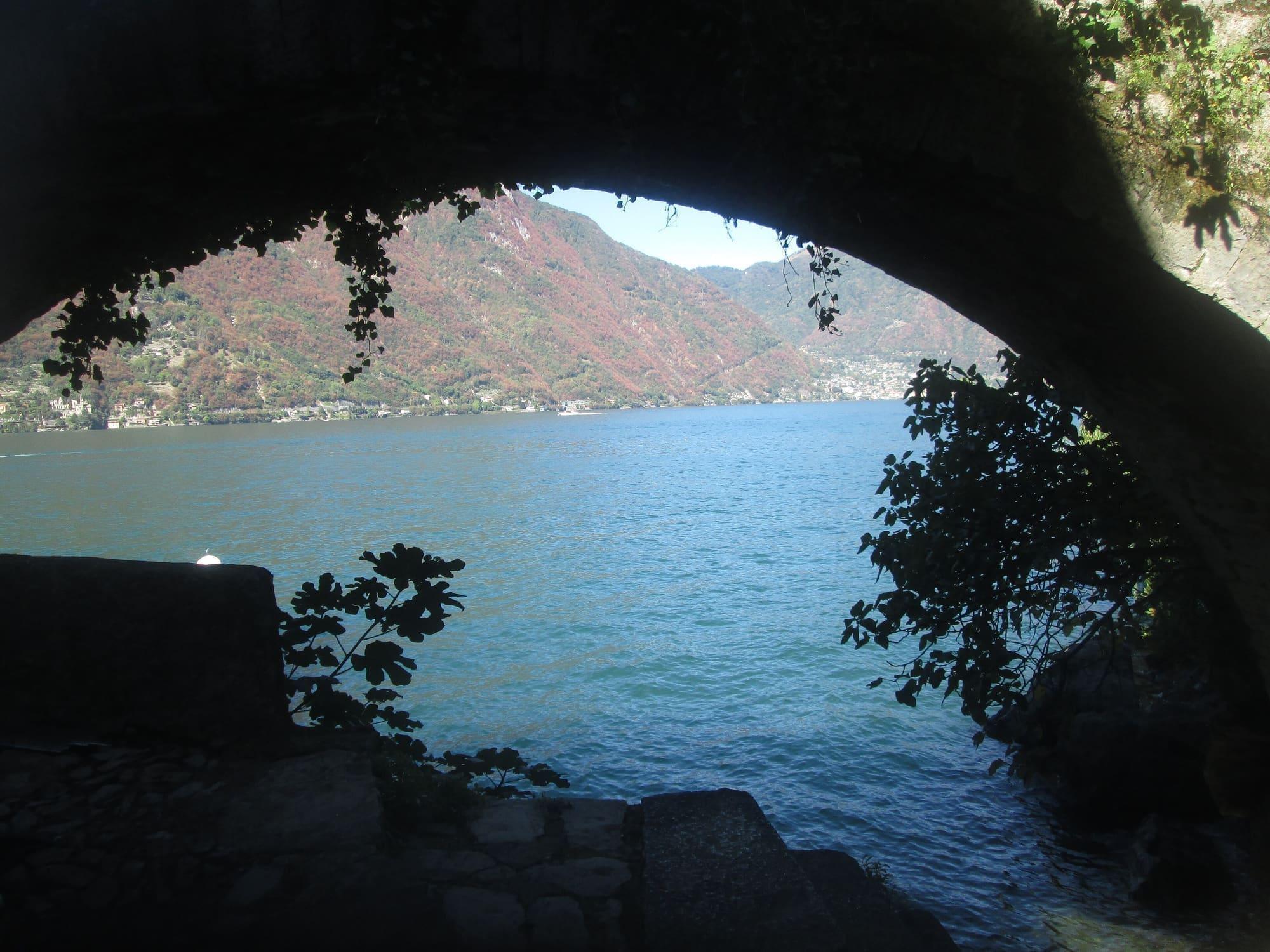
The lake framed by the arch of Nesso's bridge, above the mouth of the gorge.Giuliettom · CC BY-SA 4.0
  • Civvì · CC BY-SA 4.0
  • BelPatty86 · CC BY-SA 4.0

1 / 3

The lake framed by the arch of Nesso's bridge, above the mouth of the gorge.

Giuliettom · CC BY-SA 4.0

Why go

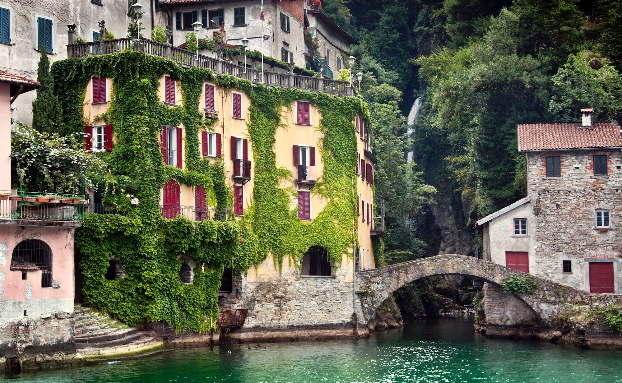
The Orrido di Nesso is the narrow, deep gorge where the Tuf and Nosee streams, coming down from the valleys of the same names, meet and plunge towards the lake: from the top of the waterfall to the shore the drop is about 200 metres. At the foot of the gorge the water enters the lake under the Ponte della Civera, a single-arched stone humpback bridge beside a little harbour. For centuries the force of the falls drove mills, paper mills, silk mills and oil presses, which made Nesso a village of workshops. Leonardo recorded Nesso in the Codex Atlanticus as the ‘place where a river falls with great force through a vast cleft in the mountain'. From the village centre a stairway of about three hundred steps drops between the houses to the bridge; the gorge can also be seen from above, from Piazza Castello.
  • You reach it on foot from the village, with no boat and no ticket.
  • In spring the flow peaks.

Highlights

  • The Civera bridge
  • The tiny harbour at the foot of the ravine

Getting there

  • C130 Como–Bellagio bus, Nesso stop; then on foot down from the centre.
The arched Ponte della Civera over the mouth of the gorge, between the ivy-covered house with red shutters and a stone house, with the waterfall in the cleft behind and green water in front.Luigi_Siclari · CC BY-SA 4.0

Practical information

Difficulty

About 300 steps down and back up, with no alternative route

Facilities

Car park 35 m away · free

Distances from the point on the map.

The light

The gorge is nearly always in shadow: the sun enters only around midday, the one hour when the waterfall and the bridge share the same light. In spring there is more water.

Faces
east
Best light
midday
Full moon
Tue 24 Nov · 20:16 · east
JuneDecember
15°30°ESW
The skyline measured every two degrees out to twenty-two kilometres, and to two hundred where the near mountains let the Alps show. The solid line is the sun's arc at the summer solstice, which leaves the top of the frame; the dashed one is the winter solstice, with the hour it comes out from behind the mountain and the hour it goes back.

See from here where the sun goes, in 3D

All the photo spots

Updated 23 October 2026

The mountains from here

The highest summit in view from here is Monte Costone, 1441 m, 8 kilometres away.

Open the panorama with the summits by name
Monte di Binate, 1271 m, 3.9 kmMonte di Binate1271Monte Comana, 1210 m, 3.2 kmMonte Comana1210Monte Gringo, 1079 m, 3.5 kmMonte Gringo1079Monte Gireglio, 974 m, 6.2 kmMonte Gireglio974Monte Pasquella, 1331 m, 6.6 kmMonte Pasquella1331Monte Costone, 1441 m, 8 kmMonte Costone1441SSWWNWNNEESE
  • Monte di Binate, 1271 m, 4 km
  • Monte Comana, 1210 m, 3 km
  • Monte Gringo, 1079 m, 4 km
  • Monte Gireglio, 974 m, 6 km
  • Monte Pasquella, 1331 m, 7 km
  • Monte Costone, 1441 m, 8 km

The ochre line follows today's sun path and marks the estimated times of its first and last appearance above the mountains. Drag the panorama to see all of it.

How it is drawn
Paler ridges are farther away; heights are stretched two and a half times. Houses are not drawn, nor are trees within half a kilometre. Terrain © Regione Lombardia (CC BY 4.0); summits © OpenStreetMap contributors.

On the map

Explore the lake
NessoBriennoPonte della Civera, Nesso

© OpenStreetMap contributors · ODbL

What's on nearby

Events within a few kilometres, on now or coming up.

See all

Nearby: places, experiences, services

Distances as the crow flies.

Sources and credits

Sources and credits