


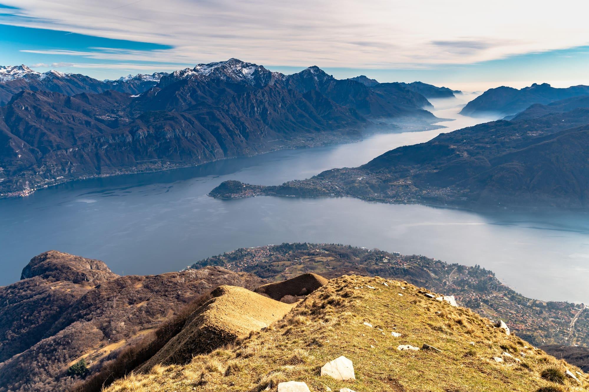
The lake's Y shape explains why its shores are linked by ferries rather than bridges.
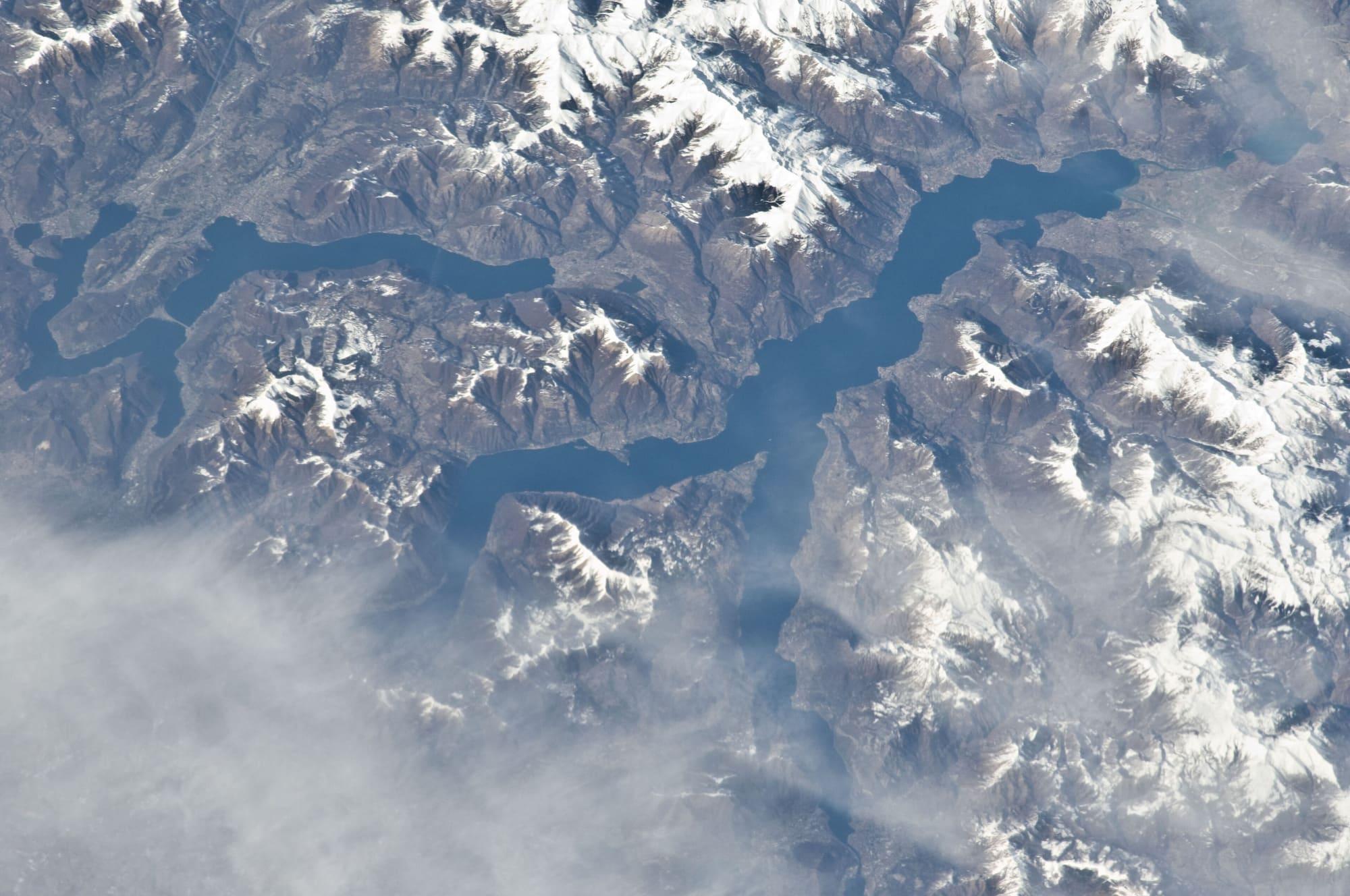
Punta Spartivento, ten minutes' level walk from the centre of Bellagio, is where the lake divides. In front lies the central basin, towards Menaggio and Varenna; behind, the two branches begin, the Como branch and the Lecco branch. The lake is shaped like a Y, with its two branches pointing south, and that shape also decides how people get from one shore to the other.
A valley cut by ice
The lake fills a narrow, deep valley. During the Quaternary glaciations the tongue of the Adda glacier came down from the Valtellina towards the Po plain several times, and each time it deepened a furrow that already existed, cut earlier by water along fracture lines in the rock. Unlike a river, ice can dig below sea level: a river cannot go lower than the sea, which is its base level.
The surface of the water lies just under two hundred metres above sea level and the maximum depth is over four hundred metres, so the bed of the lake lies about two hundred metres below sea level. It is the deepest lake in Italy. Its area is about 145 square kilometres, less than Garda or Maggiore, but its shoreline is over 170 kilometres long, the longest in Italy. The lake is forty-six kilometres long and at most a little over four wide.
The bed of Lake Como lies about two hundred metres below sea level.
The maximum depth is 410 metres, in the stretch between Argegno and Nesso.
Why two branches
Coming from the north, the glacier met a mountain massif, the one now called the Triangolo Lariano, with Monte San Primo at 1,682 metres. The ice split into two tongues that followed two existing valleys: one south-west towards Como, the other south-east towards Lecco. Bellagio stands at the tip of that massif. From the Castello di Vezio, above Varenna, you see Bellagio opposite, the Como branch on the left and the Lecco branch on the right, all at once.
The branch with no outflow
The Adda enters the lake in the north, between Colico and Gera Lario, where its sediment from the Valtellina has built the marshy plain of the Pian di Spagna, and it leaves at one point only: Lecco. The Como branch has no outflow.
At the end of the last glaciation the western branch was closed to the south by the moraine and alluvial deposits that form the sill on which Como stands, while at Lecco the water kept a lower way out, cut in the rock, which the Adda had already been following.
This is why, in times of flood, the lake spills onto Como's lakefront and Piazza Cavour goes under water. The lake's level is regulated below Lecco, at the Olginate dam, but the Como branch has no outlet of its own. On flood days people walk along the lakefront on wooden boardwalks.
What it changes for travellers
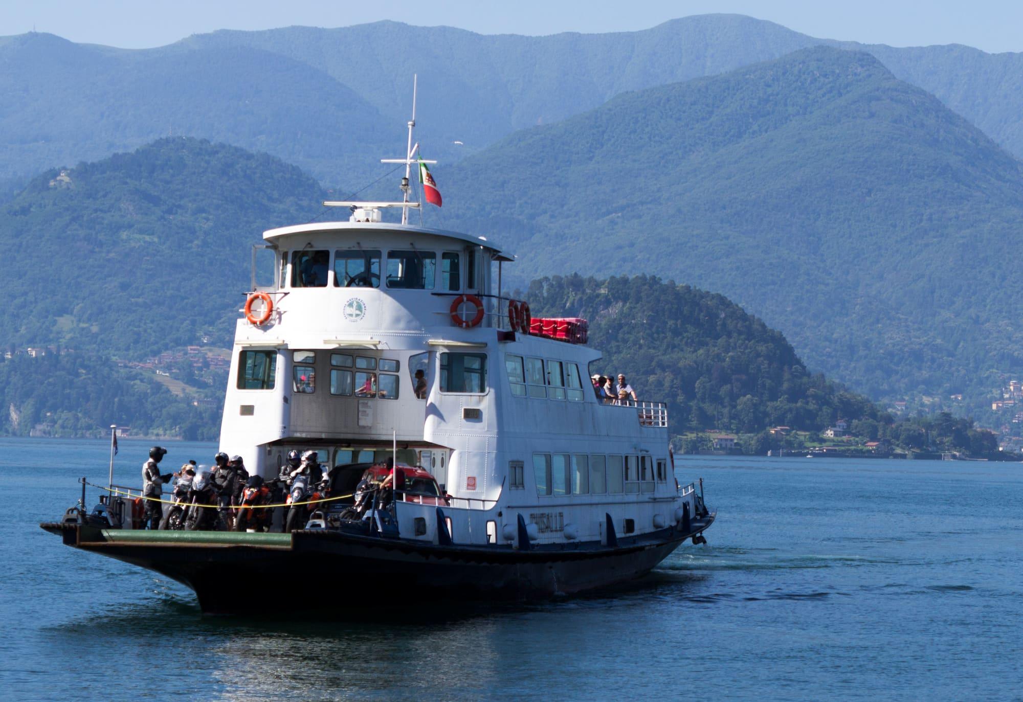
There are no bridges and no tunnels between the two shores of the central lake. The ferry between Varenna and Bellagio takes a quarter of an hour; by road you have to go round through Lecco, down the eastern shore to the city and back up the other side of the arm.
The same geometry explains the railway. The line that divides at Colico towards the Valtellina and the Valchiavenna runs along the eastern shore, where the furrow continues north without a break: Lecco, Abbadia Lariana, Mandello del Lario, Lierna, Varenna, Bellano, Dervio, Colico. The western shore has no railway: the narrow Statale Regina runs along it, with tunnels where traffic takes turns. Without a car, the western shore is travelled by bus and by boat.
What it changes for the water
At over four hundred metres deep, the lake holds a great deal of heat. It does not freeze, except in a few very shallow inlets of the upper lake, and it tempers the climate of its shores, milder in winter and cooler in summer. This is why camellias and olive trees grow outdoors at this latitude.
The depth has another consequence: the shores drop steeply and there is no low, sandy strip to form beaches. Where there is a beach, such as the Riva Bianca at Lierna, the shore at Domaso or the plain at Gera Lario, it was usually built by a stream's delta, or it is where the bed of the upper lake starts to rise towards the Adda plain.
Where to see it
The shape of the lake can be seen well from four places. Punta Spartivento, open to all. The Castello di Vezio, a twenty-five-minute climb from Varenna. The Como–Brunate funicular, which climbs about five hundred metres above the first basin in seven minutes. Monte San Primo, two hours' walk, from which both branches and the massif between them can be seen together.